Grid References
Remember that the grid reference defines the bottom left corner of a 100m square in which the feature lives. Many people mark their maps with a dot at the grid ref crosshairs then draw a circle around it. This effectively puts them out by up to 100m. Always identify and circle the described feature within the 100m square.
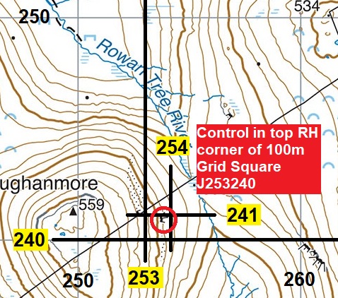
The 8 figure GPS reference for southern end of the crag was 2538 2409 so it just crept into the 6 figure square by a few metres. Anything we checked against the Harvey map on the Garmin came out accurate within 10m (Terry McQueen, Course Planner).
Over or Around
An important decision on a long day out is whether to go over a hill or around it. You can calculate the standard time for either option using Naismith’s Rule but you also need to factor in things such as: the terrain, which muscles are least tired, how good your contouring is etc.